|
||
|
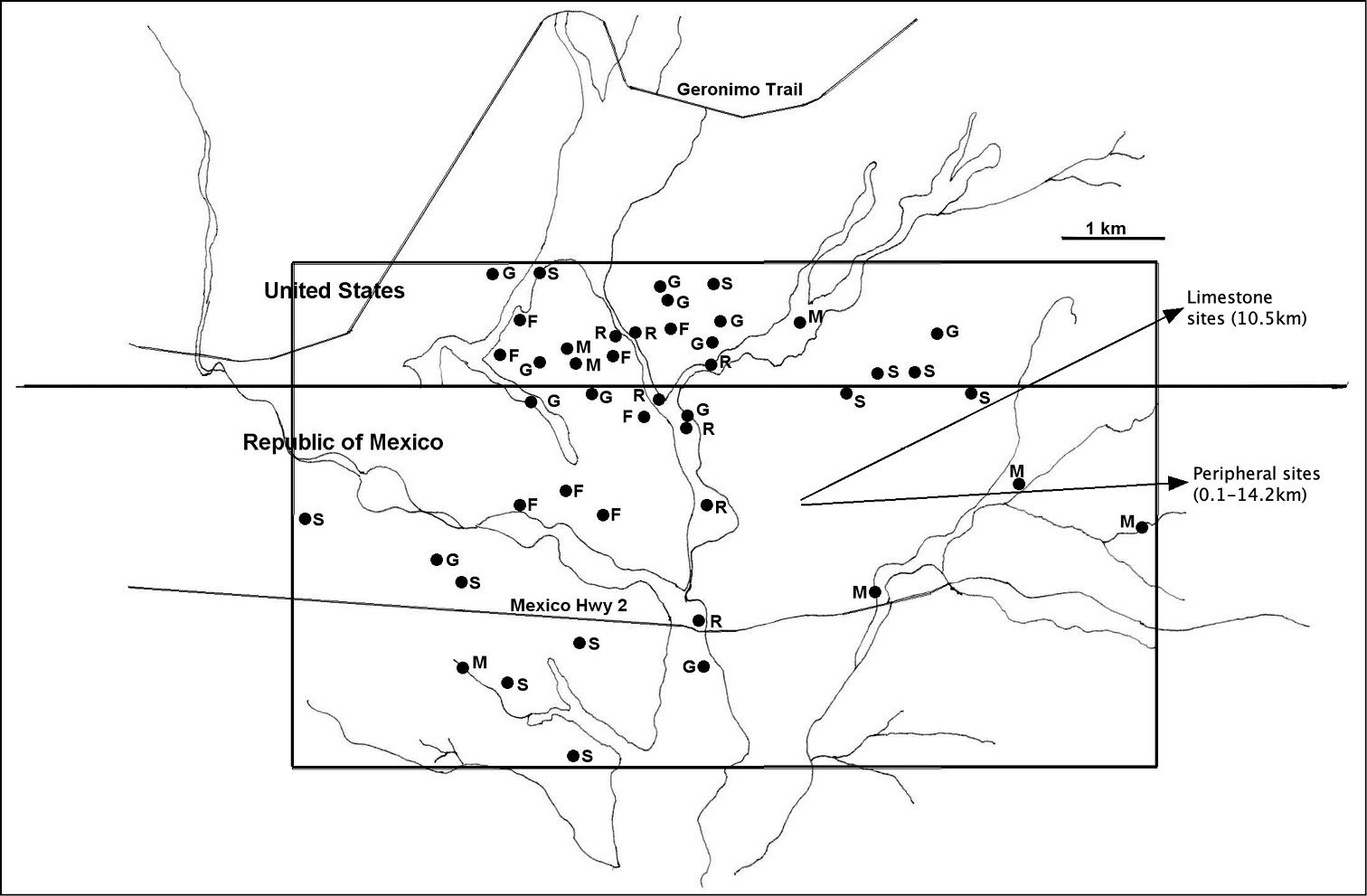
Map of the study area in the San Bernardino Valley (modified from Minckley 2014). Dots are the permanent sites where 2001 pan trap collections were made. Letters next to each permanent site indicate the habitat; F = field, G = grassland, M = mesquite, R = riparian, and S = scrub. The core area is delimited by the rectangle spanning the Mexico – United States border. The peripheral and limestone collection sites are not shown but the direction and distance from the center of the core area are indicated on the right side of the map. |